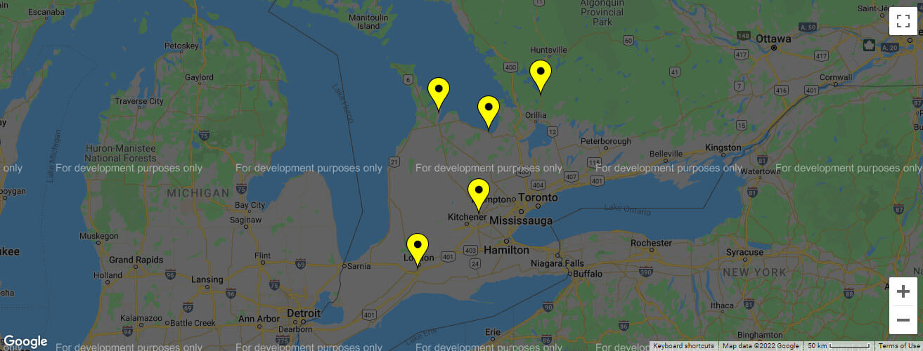
Map Styles: Snazzy Maps
API Map - Multiple Locations

HTML
<!--API Map - Multiple Locations-->
<div class="map">
	<div id="map"></div>
</div>

<script type="text/javascript">
	var LocationData = [
	    [43.5489907, -80.3097019, "<div class='marker_info'><p>GUELPH OFFICE</p><p>54 Monarch Rd, Unit-1, Guelph, ON</p><p>Phone: <a href='tel:+1519-826-6969'>+1519-826-6969</a></p></div>"],
	    [44.6804908, -80.9335211, "<div class='marker_info'><p>OWEN SOUND OFFICE</p><p>319414 Grey Rd 1, Owen Sound, ON</p><p>Phone: <a href='tel:+1519-371-1500'>+1519-371-1500</a></p></div>"],
	    [42.9214824, -81.2628909, "<div class='marker_info'><p>LONDON, ON OFFICE</p><p>207 Exeter Road, London, ON</p><p>Phone: <a href='tel:+1519-668-1555'>+1519-668-1555</a></p></div>"],
	    [44.4825997, -80.1573887, "<div class='marker_info'><p>COLLINGWOOD OFFICE</p><p>9485 Beachwood Road, Collingwood, ON</p><p>Phone: <a href='tel:+1705-445-3540'>+1705-445-3540</a></p></div>"],
	    [44.8817582, -79.3447766, "<div class='marker_info'><p>MUSKOKA OFFICE</p><p>2251 Highway 11 South, Gravenhurst, ON</p><p>Phone: <a href='tel:+1705-689-8688'>+1705-689-8688</a></p></div>"]
	];

	function initialize() {
	    var map = new google.maps.Map(document.getElementById('map'), {
			zoom: 7,
			center: new google.maps.LatLng(43.9982, -80.5777),
	        navigationControl: false,
	        mapTypeControl: true,
	        scaleControl: true
	    });

	    var bounds = new google.maps.LatLngBounds();
	    var infowindow = new google.maps.InfoWindow({
	        disableAutoPan: true
	    });

	    var customMapType = new google.maps.StyledMapType([
	        {
	            "featureType": "water",
	            "elementType": "geometry",
	            "stylers": [
		            {"color": "#e9e9e9"},
		            {"lightness": 17}
	            ]
	        },
	        {
	            "featureType": "landscape",
	            "elementType": "geometry",
	            "stylers": [
		            {"color": "#f5f5f5"},
		            {"lightness": 20}
	            ]
	        },
	        {
	            "featureType": "road.highway",
	            "elementType": "geometry.stroke",
	            "stylers": [
		            {"color": "#000"},
		            {"lightness": 29},
		            {"weight": 0.2}
	            ]
	        },
	        {
	            "featureType": "road.arterial",
	            "elementType": "geometry",
	            "stylers": [
		            {"color": "#fff"},
		            {"lightness": 18}
	            ]
	        },
	        {
	            "featureType": "road.local",
	            "elementType": "geometry",
	            "stylers": [
		            {"color": "#ffffff"},
		            {"lightness": 16}
	            ]
	        },
	        {
	            "featureType": "poi",
	            "elementType": "geometry",
	            "stylers": [
		            {"color": "#f5f5f5"},
		            {"lightness": 21}
	            ]
	        },
	        {
	            "featureType": "poi.park",
	            "elementType": "geometry",
	            "stylers": [
		            {"color": "#dedede"},
		            {"lightness": 21}
	            ]
	        },
	        {
	            "elementType": "labels.text.stroke",
	            "stylers": [
		            {"visibility": "on"},
		            {"color": "#ffffff"},
		            {"lightness": 16}
	            ]
	        },
	        {
	            "elementType": "labels.text.fill",
	            "stylers": [
		            {"saturation": 36},
		            {"color": "#333333"},
		            {"lightness": 40}
	            ]
	        },
	        {
	            "elementType": "labels.icon",
	            "stylers": [
		            {"visibility": "on"}
	            ]
	        },
	        {
	            "featureType": "transit",
	            "elementType": "geometry",
	            "stylers": [
		            {"color": "#f2f2f2"},
		            {"lightness": 19}
	            ]
	        },
	        {
	            "featureType": "administrative",
	            "elementType": "geometry.fill",
	            "stylers": [
		            {"color": "#fefefe"},
		            {"lightness": 20}
	            ]
	        },
	        {
	            "featureType": "administrative",
	            "elementType": "geometry.stroke",
	            "stylers": [
		            {"color": "#fefefe"},
		            {"lightness": 17},
		            {"weight": 1.2}
	            ]
	        }
	    ], {
	        name: 'Custom Style'
	    });

	    var customMapTypeId = 'custom_style';

	    var image = '/img/marker.png';

	    for (var i in LocationData) {
	        var p = LocationData[i];
	        var latlng = new google.maps.LatLng(p[0], p[1]);
	        bounds.extend(latlng);

	        var marker = new google.maps.Marker({
	            position: latlng,
	            map: map,
	            icon: image,
	            name: p[2]
	        });

	        google.maps.event.addListener(marker, 'click', function () {
	            infowindow.setContent(this.name);
	            infowindow.open(map, this);
	        });
	    }

	    map.mapTypes.set(customMapTypeId, customMapType);
	    map.setMapTypeId(customMapTypeId);
	}

	google.maps.event.addDomListener(window, 'load', initialize);
</script>